 KAI-River
Every cross-section and gauging in one place, straight to HEC-RAS.
KAI-River
River surveys, rating curves and hydraulic models
River surveys, ADCP gaugings and rating curves are collected by different teams in different formats and rebuilt by hand for each model.
KAI-River will keep cross-sections, gaugings, rating curves and survey datums in one shared web database, and export them straight to HEC-RAS 1D and 2D.
What it will do- One database for cross-sections and gaugings
- ADCP processing and rating-curve updates
- Survey datums kept consistent
- Export to HEC-RAS 1D and 2D
Early access is free. Members hear first when it launches and get an introductory price.
Products you can use now
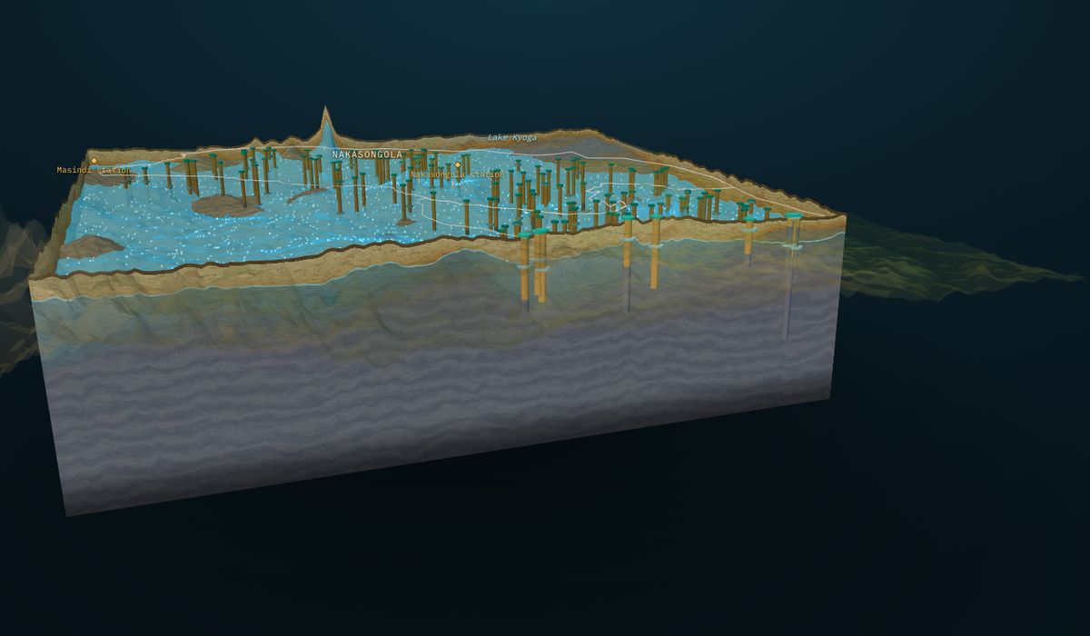
 GroundWater Analyst
3D groundwater models from borehole records: water table, bedrock, aquifer layers, boreholes and flow, with cross-sections anywhere.
Free plan · paid from $149 per site
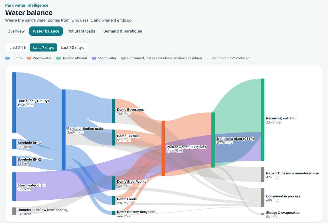
 HydroSaaS
Water balance, pollutant loads and sources, demand and borehole drawdown, and effluent compliance against NEMA limits.
Free plan · paid from $99 per month
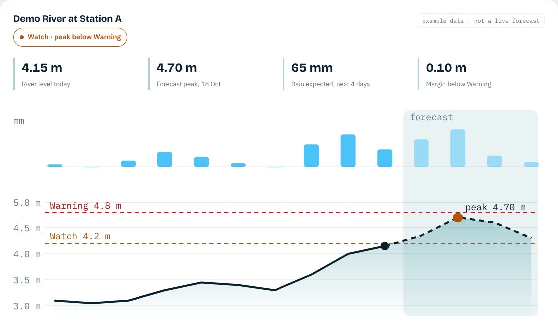
 KAI-Hydro
Daily flood and drought forecasts for your river sites, ending in a plain Normal, Watch or Warning, with alerts.
Free plan · paid from $190 per month
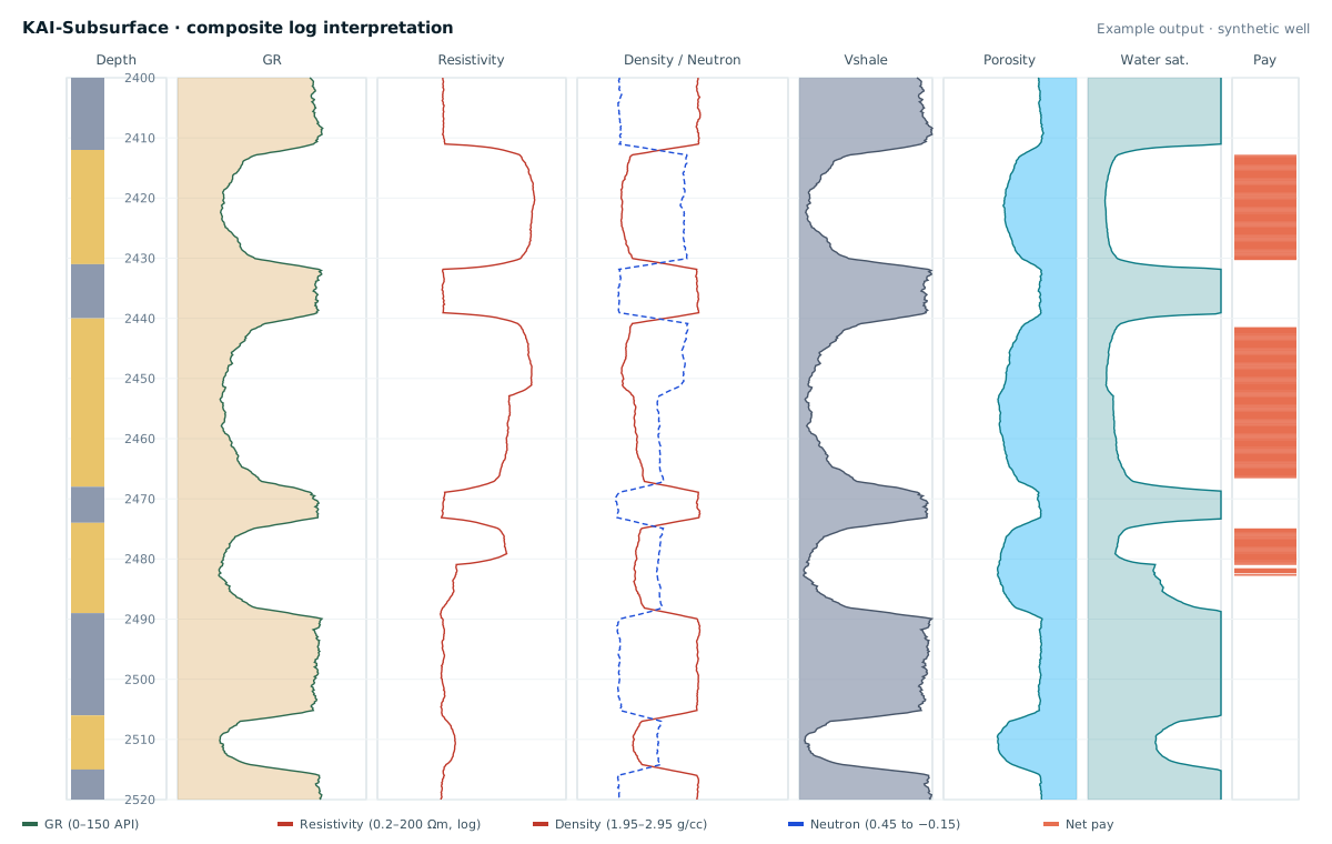
 KAI-Subsurface
Fixed-price well-log interpretation, geomodels and AI property prediction between wells.
Free plan · paid from $490 per well